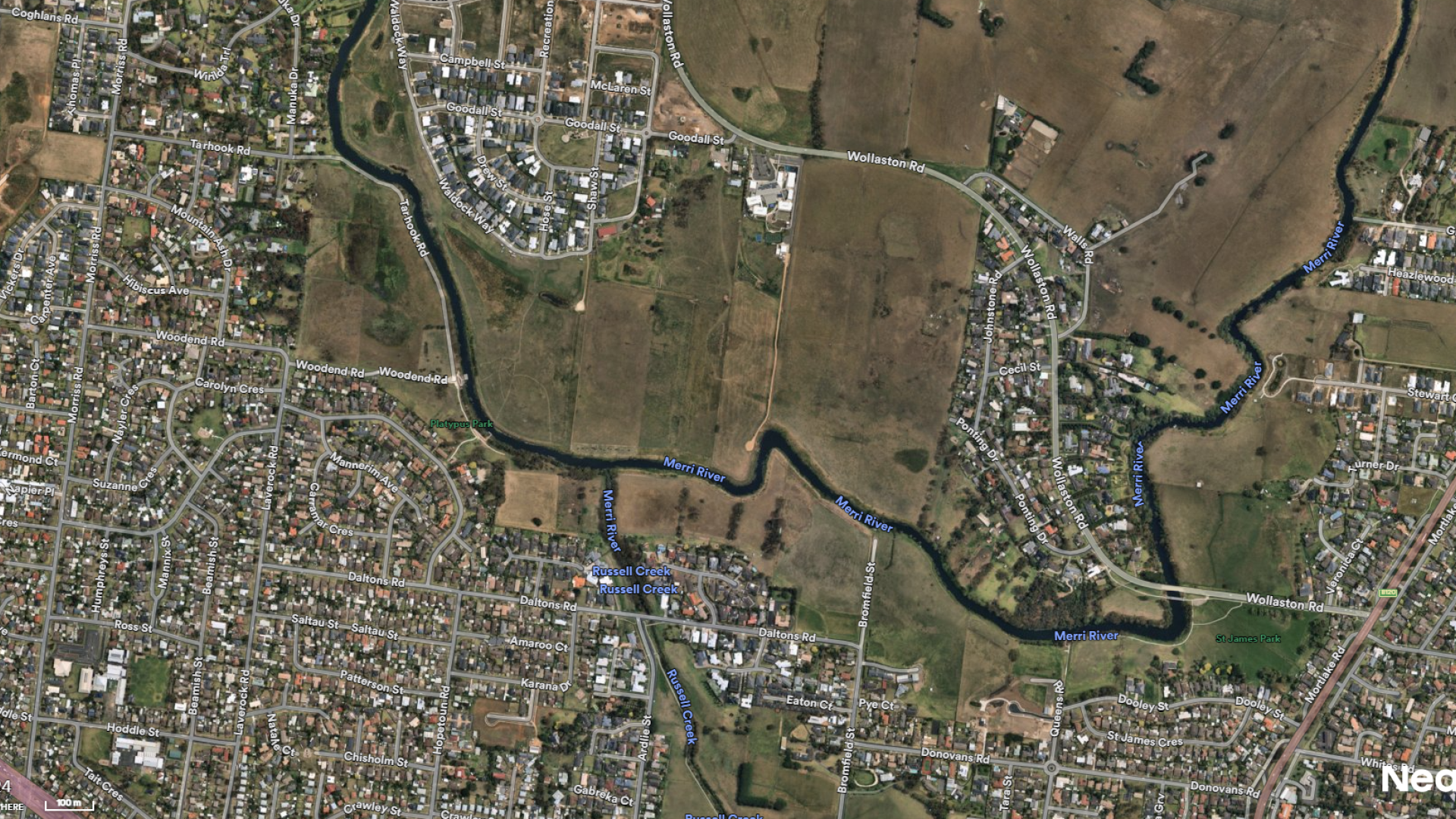
Open space on the northern banks of the Merri River is an important asset that provides wildlife habitat, recreational opportunities and has cultural heritage significance.
Specialist ecology and landscape design consultants have developed a draft North Merri Open Space Masterplan that will cover 40ha of current and proposed public open space north of the Merri River, from established properties in the east (Ponting Drive and Johnstone Road) to Caramut Road in the west.
The plan will:
• Guide the planting of appropriate species and landscaping outcomes in the riparian corridor.
• Improve conservation and cultural values.
• Maintain the underlying purpose and function of the flood zone.
• Create linkages with the South Merri open space precinct and adjoining residential open space areas.
The consultants have met representatives of local interest groups including Warrnambool Coastcare Landcare Network, the Warrnambool Field Naturalists Club, the Australian Plant Society and the Eastern Maar Aboriginal Cooperation and Government Authorities with jurisdiction of the area.
The floodplain status of the land restricts the building of infrastructure of buildings that would restrict overland stormwater flow. The area does provide major opportunity for passive recreation, particularly for residents of the recent subdivisions to the north side of the river.
The master plan’s key recommendations are:
- The first priority is weed eradication on the river’s embankment and around existing indigenous trees and shrubs. Revegetation will include laying of biodegradable matting to reduce weed development and protection from erosion, followed by planting with a selection of trees, shrubs, groundcovers and tufting plants that are within the area’s ecological vegetation class.
- Future connectivity and links. There is a proposed crossing at Bromfield Street and pedestrian bridges planned to connect the north and south sides of the river.
- Preservation of views along and across the river of birdlife, canoe and kayak activities. Views provide passive surveillance and personal safety for open space users.
- Provision of a curved 2.5m wide concrete path providing access at key viewing points along the river. The path will draw pedestrians away from areas designated for wildlife habitat enhancement, to minimise disturbance by people and dogs. The path will connect to open spaces, some consisting of native grass and groundcover planting.
- Affordable maintenance. Most of the area will remain under the current maintenance schedule, primarily grass slashing.
- Eradication of invasive weeds along the river bank and to the groups of existing indigenous trees and shrubs close to the river bank, which are a major impediment to biodiversity improvements.
- Upgrade the function and filtration capability of two retarding basins and one large wetland. The Hose Street basin was recently cleared of some vegetation and had silt removed. The associated filtration wetland will be improved in capacity and weed eradication with appropriate reeds and rushes to be planted.
The Draft North Merri Open Space Master Plan is now available for review.
Residents are encouraged to read the draft plan and provide feedback below.